Research Interest
- Machine/ Deep Learning in Water Resources
- Optimization & Multi-Criteria Decision Making
- Remote Sensing and GIS
- Water Quality
- Surface and groundwater hydrology
- Climate Change
About me
As an Environmental Engineer with a focus on water resources management, I combine traditional engineering approaches with cutting-edge data science techniques to address complex environmental challenges. My journey from Civil Engineering to a Master's in Environmental Engineering from the University of Tehran has equipped me with a unique perspective on water resource management.
My research centers on developing innovative, machine-learning-driven methods for analyzing satellite data and creating flood risk mapping systems, leveraging my expertise in remote sensing, GIS environmental analysis, and water quality modeling. With a strong focus on addressing water resource challenges, I am dedicated to creating sustainable solutions that tackle climate change impacts, enhance flood and drought resilience, and improve surface and groundwater hydrology. My work integrates advanced computational methods with environmental engineering principles, aiming to contribute to more effective, sustainable water management practices that protect essential water resources.
Education
M.Sc. Environmental Engineering - Water Resources
2018 - 2021
University of Tehran, Tehran, Iran
GPA: 17.73/20
B.Sc. Civil Engineering
2011 - 2015
University of Guilan, Rasht, Iran
GPA: 15/20
Research Experience
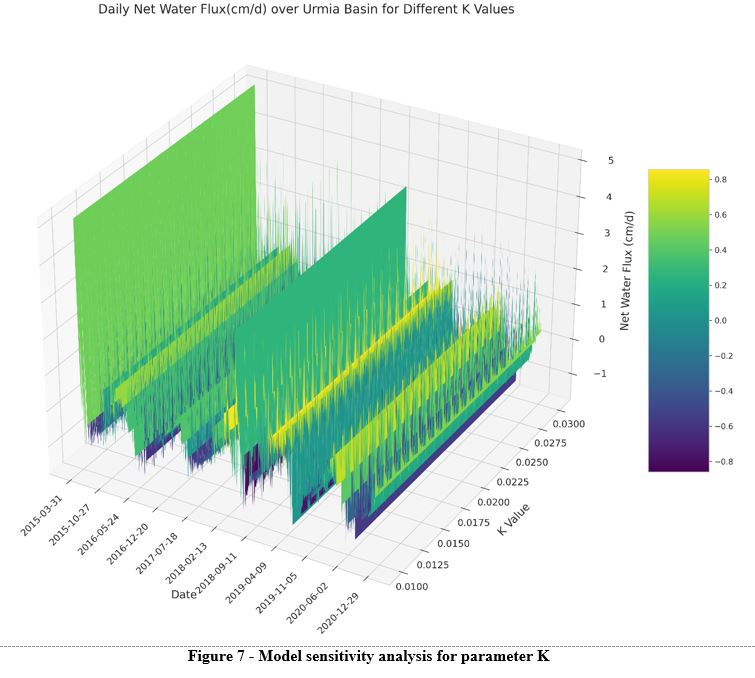
Master Thesis: Estimation of Net Water Flux Using Satellite Soil Moisture Data
2019 - 2021
Supervised by Prof. Mohammad Hossein Niksokhan and Dr. Amir Houshang Ehsani
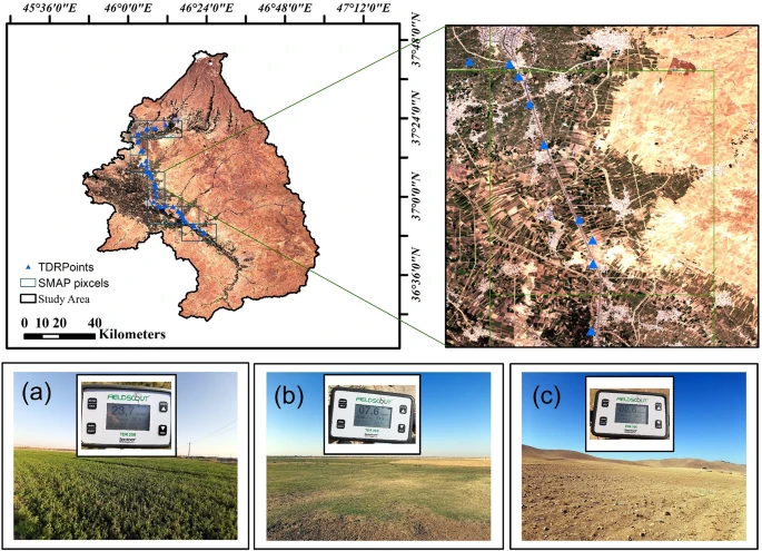
Summary: The net water flux in Lake Urmia, Iran, was estimated in this master's thesis, utilizing satellite soil moisture data. Field data were collected using a TDR soil moisture meter for validation, and the Google Earth Engine was applied for classification using Sentinel-2 imagery. To predict Lake Urmia's water level, advanced machine learning models (RNN, LSTM, and GRU) were employed with soil moisture data from SMAP satellite data. This research contributes to ecological understanding and water management of Lake Urmia through novel applications of these technologies.
Key Findings: Effectively used advanced machine learning models (RNN, LSTM, GRU) to predict Lake Urmia's water level, with the GRU model outperforming traditional methods. The study validated the efficacy of satellite-derived soil moisture data and demonstrated the potential of these technologies in ecological monitoring and water resource management.
Teaching Experiences
Teaching Assistant, Environmental Engineering, University of Tehran, Iran
2020 - 2023
Supervisor: Prof. Mohammad Hossein Niksokhan
- Hydro Informatics (2020-2021)
- Application of Remote Sensing in Water Resources: Taught the use of Google Earth Engine for evaluating precipitation products, guided students in climate-based data analysis projects, assisted in remote sensing research, and evaluated related student projects.
- Application of Machine Learning for Flood Zone Mapping (2021-2023): Introduced machine learning concepts for flood zone mapping, led practical sessions on model development, assisted in flood risk analysis, and facilitated projects combining machine learning with hydrological data.
- River Engineering (2020-2023)
- Monitoring the Changes of Rivers in Flood Plains Using Satellite Images: Led workshops on using satellite imagery and GIS to monitor river changes in floodplains, including practical analysis techniques, floodplain analysis, project guidance, and evaluation of student research.
Selected Academic Projects
Application of QUAL2K Model for Simulating Water Quality in Minab River, Iran
2019
Supervised by Prof. Mojtaba Ardestani
- Conducted a project to simulate water quality in the Minab River using the QUAL2K model.
- Collected relevant data, performed model calibration and validation, and analyzed the results to assess water quality parameters and their impact on the river ecosystem.
Application of SWAT for Watershed Modeling through GIS Framework in Goghain Basin, Iran
2020
Supervised by Prof. Mohammad Hossein Niksokhan
- Employed the Soil and Water Assessment Tool (SWAT) in combination with a GIS framework to model and assess watersheds in the Goghain Basin.
- Collected relevant data, parameterized the model, and simulated hydrological processes to evaluate water resources, land use impacts, and water quality parameters.
Application of HEC-RAS for Hydrodynamic Modeling through GIS Framework in Gavi River, Iran
2020
Supervised by Prof. Mohammad Hossein Niksokhan
- Utilized HEC-RAS in conjunction with a GIS framework to conduct hydrodynamic modeling in the Gavi River.
- Integrated river geometry, flow data, and topographic information to simulate river behavior, identify flood-prone areas, and assess hydraulic characteristics.
Related Courses
2018 - 2019
- Groundwater Hydrology
- Surface Water Hydrodynamic
- Environmental Engineering Fundamentals 1
- Water Resources Systems Planning
- Water Resources Quality Management
- River Engineering
- Water Quality
2019 - 2020
- Groundwater Hydrodynamic
- Surface and Groundwater Pollution
- Environmental Engineering Fundamentals 2
- Hydro Informatics
- Recovery and Reuse of Water
- Pollution Load Measurement in Aquatic Environment
Publications

2024
Estimation of Net Water Flux and Its Relationship with Hydrological and Ecological Parameters in the Urmia Lake Basin

2023
Enhancing Spatial Resolution of Satellite Soil Moisture Data through Stacking Ensemble Learning Techniques (under review)

2021
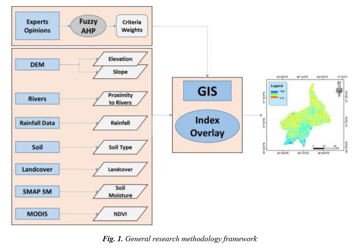
Flood Risk Mapping Using GIS-based Multi-Criteria Decision-Making (A Case Study: Miandoab Basin)

2018
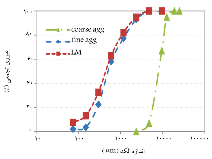
Rheological and Mechanical Properties of Fiber Self-Compacting Concrete Under High Temperature
Skills
-
Geospatial Analysis & Environmental ModelingProficient in ArcGIS and Google Earth Engine for geospatial data processing; experienced in using SWAT for watershed analysis and management.
-
Hydraulic & Water Quality ModelingSkilled in the application of HEC-RAS for hydraulic simulations; adept in using QUAL2KW for water quality modeling in river systems.
-
Programming & Data AnalysisProficient in Python, specifically for machine learning and data analysis applications; capable of integrating Python with geospatial and environmental data analysis tools.
-
Remote Sensing & Satellite Data ProcessingExperienced in utilizing remote sensing techniques and tools, particularly Google Earth Engine, for environmental monitoring and analysis.
-
Hydrological Software ProficiencyDemonstrated expertise in using specialized hydrological and environmental software such as SWAT and HEC-RAS for comprehensive watershed and river studies.
